- Back button/Page style
- Planning document information
-
Description
A location plan shows the site in relation to the wider area, so anyone looking at the plans can quickly and easily identify where the proposed development is.
Guidance
You can buy location plans in the correct format for your application from the Planning Portal.
You must provide one copy of an up-to-date map with a metric scale of 1:1250 or 1:2500
The location plan you submit as part of your application must:
- show the application site edged in red and any other adjoining land owned or controlled by you must be edged in blue
- include all land necessary to carry out the proposed development e.g. land required for access from a public highway, visibility splays, landscaping, car parking and open areas around the building. These must be included within the area edged in red.
- cover a large area around the site, with at least two named roads, house names or numbers, and surrounding buildings notated
- include a scale bar and plan size
You can find more details of what you need to submit in our guidance on sample drawings
We recommend that you purchase location plans direct from the Planning Portal, however the guidance below should provide further clarification on what would and would not be acceptable
You can get help and advice from our Duty Planner on location plans and planning applications.
You can get detailed feedback on your proposal by using our pre-application advice service.
Personal and confidential statement
We may publish any information you submit as part of your application. You must tell us if there is any information you do not want us to publish when you submit your application.
If however, we believe that this information is in the public interest, we reserve the right to publish it.
We may also decide parts of your submission are not in the public interest and may redact this information. This information may include telephone numbers, email addresses and signatures.
- When you need to submit this information
-
You must submit a location plan if you are making an application for:
- Advertising consent
- Agricultural development
- Certificate of lawful use for a proposed development
- Certificate of lawful use for an existing development
- Change of use
- Commercial, industrial and non-residential
- Demolition of an unlisted building
- Householder planning consent
- Listed building consent
- Outline permission with all reserved matters
- Outline permission with some reserved matters
- Permission in principle
- Prior approval
- Prior notification
- Removal or variation of conditions
- Reserved matters
- Residential new build
- Telecommunications
You do not have to submit a location plan if you are making an application for:
- Validation requirements
-
Required by
- National requirement. You can find details of this requirement in the National Planning Policy Framework
- Local requirement. You can find details of this requirement in:
- Local plan policy - LPP1
- Local plan policy - LPP52
These policies can be found in the Local Plan 2013 - 2033 document
- Example
-
Examples
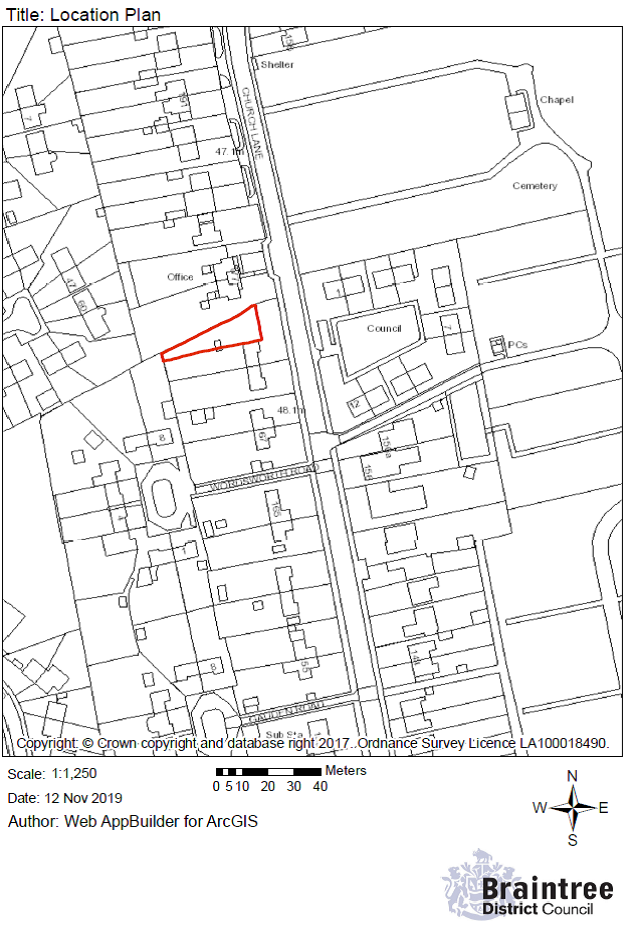
An application for a householder extension. The RED Line includes the access to a highway
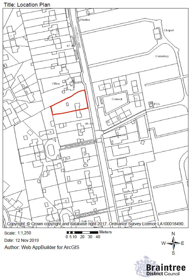
The RED Line is only drawn around the extension and not the entire property boundary
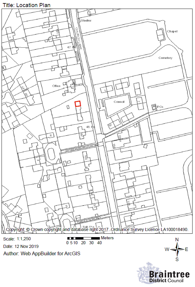
The RED Line is drawn for part of the site, not all and doesn’t include access to the highway